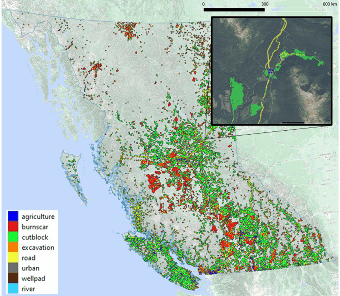
ASL is pleased to offer a new service based on satellite image change detection. Our service uses a proprietary tool called DeCAF: Detection and Classification of Anomalous Features. DeCAF automatically scans wide areas, ingests satellite data, detects and classifies changes to the landscape, and provides clean geospatial outputs to the user. DeCAF is massively scalable while providing accurate sub-pixel detections of new features. The example below shows detections across British Columbia from 2019 to 2023; the inset shows the incredible detail available.
DeCAF can detect both human disturbances (e.g., logging, urban development, mining, roads) and natural phenomena (e.g., fires, flooding, washouts, landslides). This service is ideal for a variety of applications, including remote infrastructure monitoring, environmental monitoring and compliance, disaster response, emergency management, law enforcement, and intelligence.
Our monitoring service is customizable. We offer:
• Optical- and radar-based change detection.
• 30m, 10m, or 3m spatial resolution.
• Near-real-time monitoring with regular update intervals and alerting functionality.
• Historical analysis of any region as far back as 1982.
• Tailored disturbance classifications for your application.
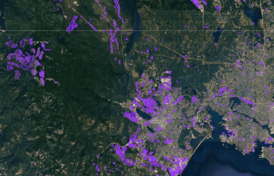
Try out our interactive map below of changes detected around Victoria, B.C. between August 2017 and August 2024.
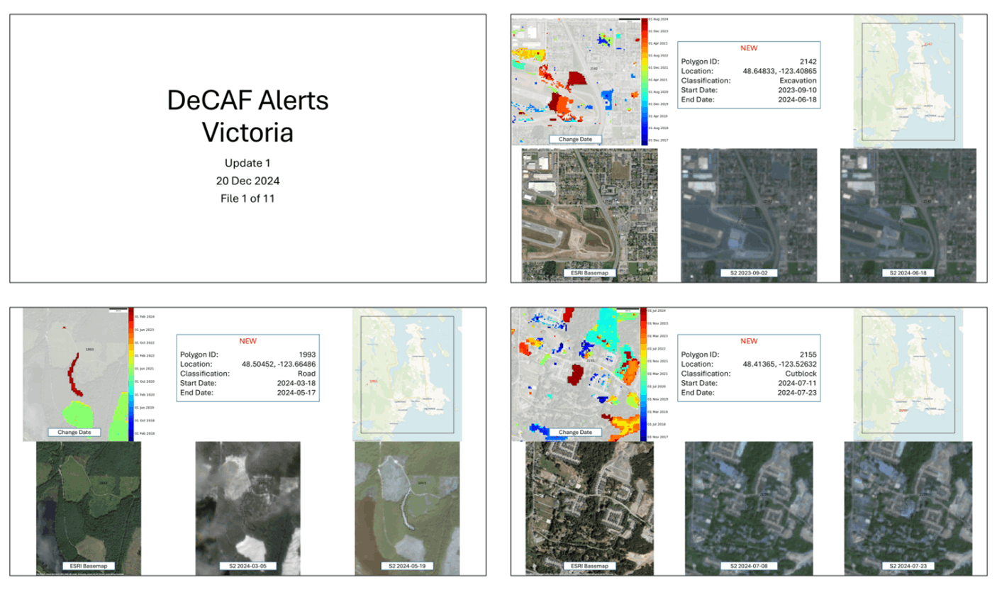
Our near-real-time monitoring service includes customizable alerts for your region of interest. These can be automatically generated and emailed in both GIS format and PowerPoint for lay users.
Our monitoring service is customizable and affordable. Contact your Kaan Ersahin for pricing and more information on how this service can fit your needs.
[email protected]
250-656-0177 ext 152
ASL Environmental Sciences #1-6703 Rajpur Place V8M 1Z5 Saanichton, BC
Canada
Phone: +1 250-656-0177
Email: [email protected]
Website:www.aslenv.com